News
Middle East Migration Studies: Taking Stock, Plotting New Paths
The 2023 Khayrallah Prize Winners
Khayrallah Center Announces 2023 Winner of Alixa Naff Prize
Call For Papers: “Locating Palestine in the Arab Americas”
Announcement: Index of Arab American Archives
Muslim Pioneers* in Canada’s North
Announcement: Undergraduate Summer Internship
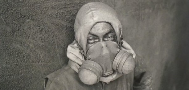
The Health Consequences of Researching our Family and Community History